
Hi, I'm Eric.
I’m an avid world traveler, photographer, software developer, and digital storyteller.
I help implement the Content Authenticity Initiative at Adobe.
Hi, I'm Eric.
I’m an avid world traveler, photographer, software developer, and digital storyteller.
I help implement the Content Authenticity Initiative at Adobe.
24 March 2019 • 3218 km / 2000 mi (map)
Come to the Mediterranean, they said. It will be warm, they said.
Narrator: He took the bait.
There was a grand plan for today. It was:
It … seemed like a good idea at the time.
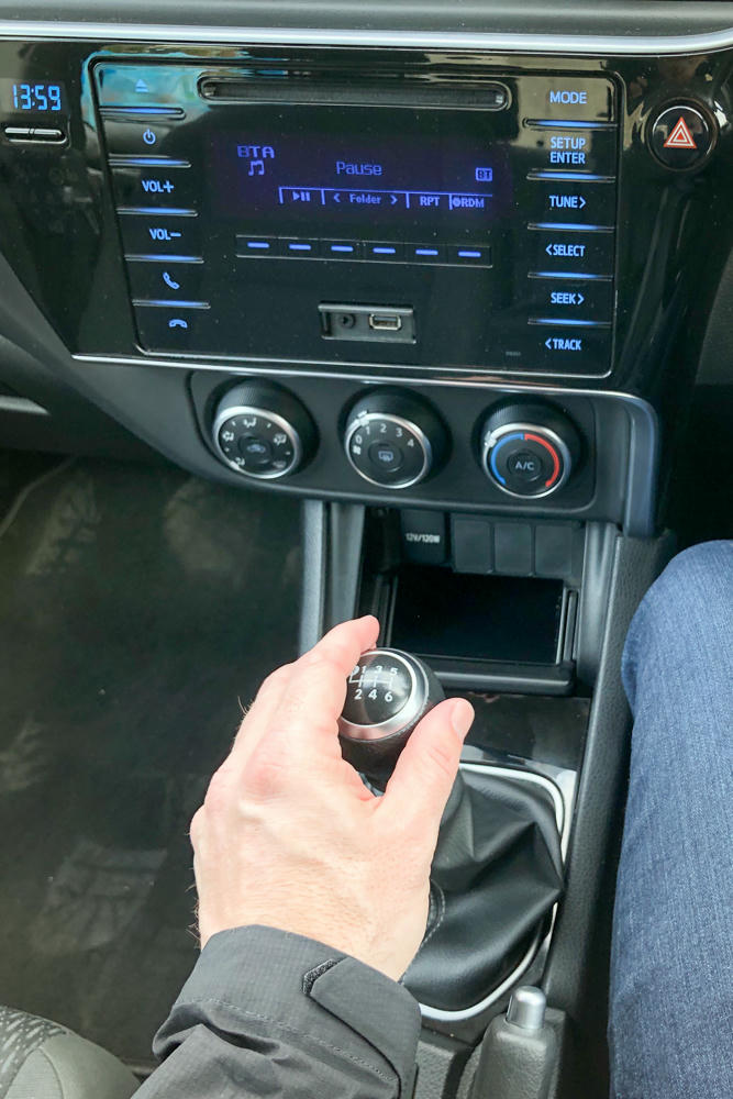
P.S. Good thing I know how to drive a stick shift, left- or right-handed. Automatics were hard to find here!
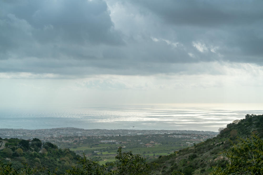
Here, you can see that I got as far as step 3. Maybe even 3½. Here is as close as I got to the northwestern most point of the island:

I made a few photos, including some fun, dramatic ones like this …

And then the rain came.
Or the … whatever the heck it was.
There was lightning. There was thunder. There were sheets upon sheets of rain. Then the rain started looking kind of white. I checked the car’s thermometer: 4 degrees. (That’s 39°F for you back in the States.)
At that point, I was no longer sure if it was rain, freezing rain, hail, or snow.
I tapped the brakes on the car. Not much happened, aside from the car bleating out a feeble warning that the road was slippery. (Fortunately, being used to things like that from my northern Minnesota upbringing, I was already driving very slowly.)
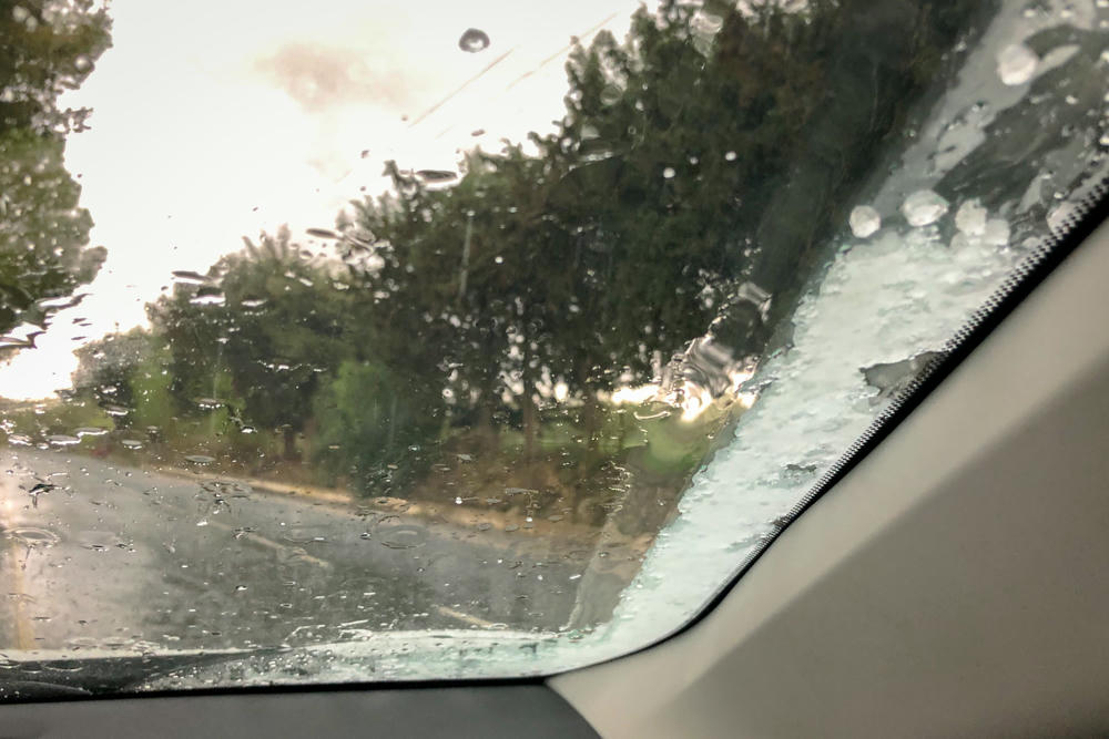
And that mostly defined the afternoon. You might understand my reticence to get out and make more photos. Getting struck by lightning and then freezing to death while getting pelted by hailstones somehow didn’t sound all that charming.

. . .
If you’ve known me for long, you know that borders fascinate me. Cyprus is particularly interesting, as it divided three ways: There is the primary Republic of Cyprus, there is Turkish-controlled Northern Cyprus, and there are some portions that remain under British control (military bases) following the independence granted to the rest of the island in 1960.
The border between British-controlled Cyprus and Cyprus-controlled Cyprus is even more subtle than the border between the Republic of Ireland and Britsh-controlled Northern Ireland. Google Maps showed me where the border was. I couldn’t find any evidence of it whatsoever. No customs. No mention of the change of control. Not even a “speed limits are different here” sign, as in the Irish case. Some distance in, there was a sign noting “British Forces, Episkopi.” And a bunch of signs saying “No photography,” which I respectfully observed. Perhaps the most subtle (crossable) national border I’ve yet to encounter. (Saying “crossable” reminds me that there is a fun case along the US-Canada border that I should post about someday. But not today.)
. . .
There is a new plan for tomorrow. Hopefully it doesn’t rain quite so much.
. . .
Today’s flight path is interesting as it reveals the ongoing lack of a friendly relationship between United Arab Emirates (host to Emirates Airlines, on whom I was flying) and Israel. We obviously flew south of Israel rather than flying over.

Subscribe to my free and occasional (never more than weekly) e-mail newsletter with my latest travel and other stories:
Or follow me on one or more of the socials: