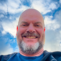
Hi, I'm Eric.

I’m an avid world traveler, photographer, software developer, and digital storyteller.

I help implement the Content Authenticity Initiative at Adobe.

Search Results

Pacific Coast Road Trip

8 November 2020 • 1564 km / 972 mi (map)

I know we don’t (and shouldn’t) get out much these days, but I needed to visit a family member in the Bay Area recently. Had a few days to get home, so that led to a coastal road trip and a park visit on the way back.

Petaluma, California
North Salmon Creek Beach, north of Bodega Bay, California
A rustic driftwood shelter built from an assortment of bleached, weathered logs and branches stands on the wet sand of North Salmon Creek Beach, with foaming waves rolling in behind it under a bright blue sky dotted with white clouds.
North Salmon Creek Beach, north of Bodega Bay, California

Mendocino, California, is one of my most favorite places in the world and I was thankful to spend my first night here.

A wide panoramic view of the rugged Mendocino coastline at sunset, with the sun glowing low over the ocean through hazy clouds as waves crash against dark rocky outcrops and cliffs. A distant headland dotted with buildings and trees stretches along the right side of the bay.
Mendocino, California
A rugged rocky coastline along Mendocino, California, where foamy white waves crash against dark rocks and sea cliffs under a golden, cloud-filled sky at sunset, with the sun breaking through clouds over the ocean horizon and a forested headland in the distance.
Mendocino, California
A rugged coastal headland at Mendocino, California, where churning turquoise surf breaks against dark rocky bluffs beneath a wide sky of mixed blue and hazy clouds. A small town with houses and trees sits atop the distant cliffs on the right, with soft late-afternoon light glowing toward the horizon on the left.
Mendocino, California
A white wooden Gothic Revival church with a tall steeple silhouetted against a glowing golden-amber sky at dusk, with two birds perched on its peaked roof and a large wind-sculpted cypress tree to the right.
Mendocino, California

That also meant I got to drive the northernmost stretch of California’s Highway 1, which introduces itself thusly. (They aren’t kidding, either. It’s one of the most windy and fun roads out there, if you’re into that sort of thing. I am.)

A two-lane highway curves to the left along a coastal hillside near Westport, California, with a yellow road sign reading “Narrow Winding Road Next 22 Miles Watch For Bicycles” standing in the dry grass beside the road. Forested slopes rise to the right under a mostly cloudy sky, with tall plumes of pampas grass in the foreground.
Westport, California

I spent the second night in Newport, Oregon, and set out at first light. That lead to this fun interplay of dawn’s light and the coastal surf a little ways north in Depoe Bay:

Depoe Bay, Oregon
Rough surf crashes against dark volcanic rocks along the rugged Oregon coast at Depoe Bay, with white foam and spray in the foreground and a wave bursting against a cliff on the right. In the distance, a tree-topped headland holds coastal houses beneath a soft blue sky tinged with golden morning light near the horizon.
Depoe Bay, Oregon
A rugged Oregon coastline at Depoe Bay with white-crested waves breaking against sun-lit sandstone rocks, while wind-sculpted pine trees cling to a rocky headland on the right beneath a pale, hazy sky.
Depoe Bay, Oregon
A pale morning sun breaks through thick low fog over a green pasture north of Cloverdale, Oregon, with bare silhouetted trees scattered across the misty field and a dirt path curving through the grass.
north of Cloverdale, Oregon
Berkeley, California, to Poulsbo, Washington · 1564 km / 972 mi
(Mouse over or tap on the markers to see the photos there. Use the button to adjust the map’s position and zoom.)

If you’ve enjoyed this …

Subscribe to my free and occasional (never more than weekly) e-mail newsletter with my latest travel and other stories:

Or follow me on one or more of the socials: