Hi, I'm Eric.

I’m an avid world traveler, photographer, software developer, and digital storyteller.

I help implement the Content Authenticity Initiative at Adobe.

Search Results

Sunshine Coast

5 October 2025 359 km / 223 mi (map)

  • Added to Eric Scouten :: Travel on 6 November 2025
  • Canada 13

I’ve long been curious about the so-called Sunshine Coast area to the northwest of Vancouver, British Columbia.

I decided to treat myself to a solo roadtrip for the weekend into British Columbia, where I spent two nights in a very nice AirBNB in Langley.

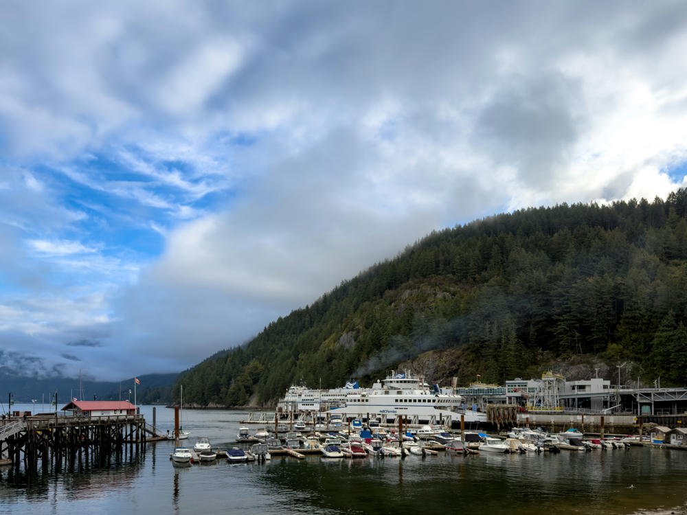
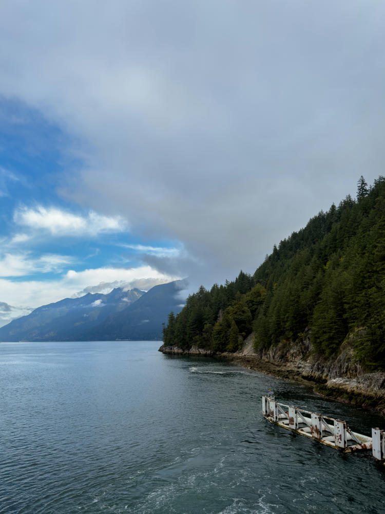
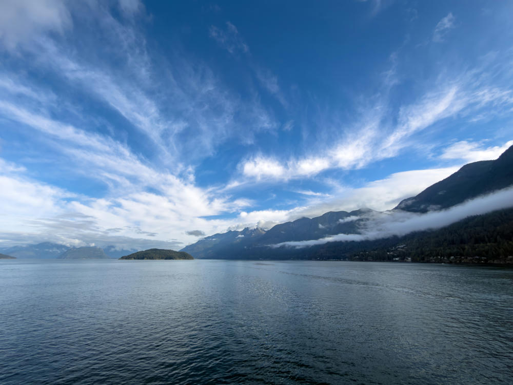
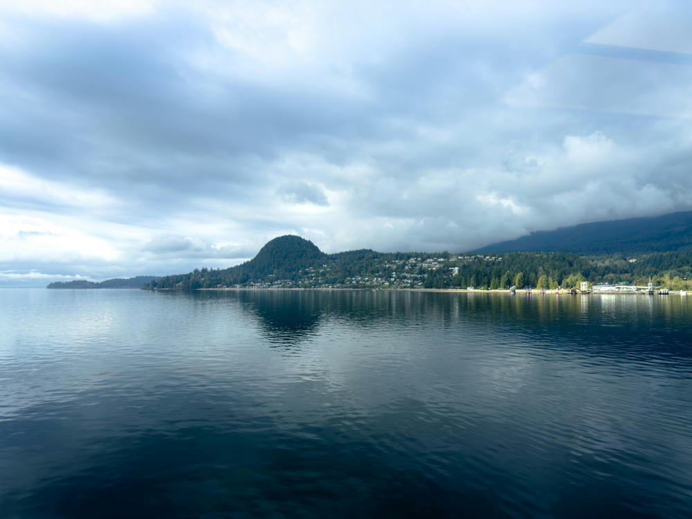
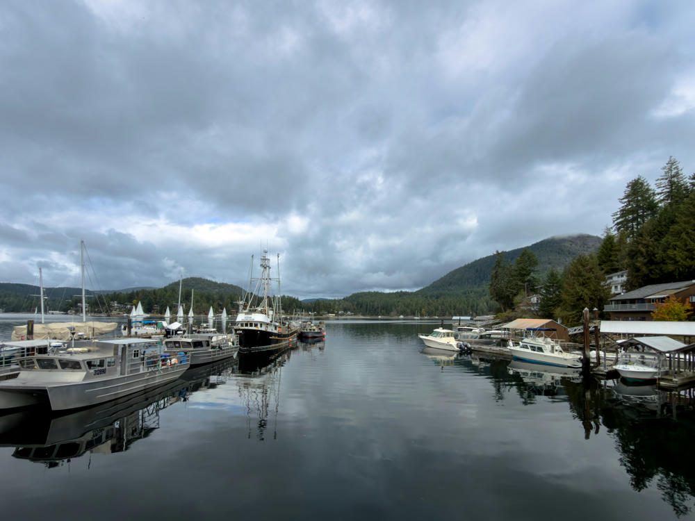
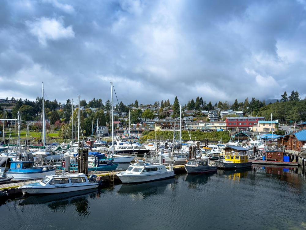
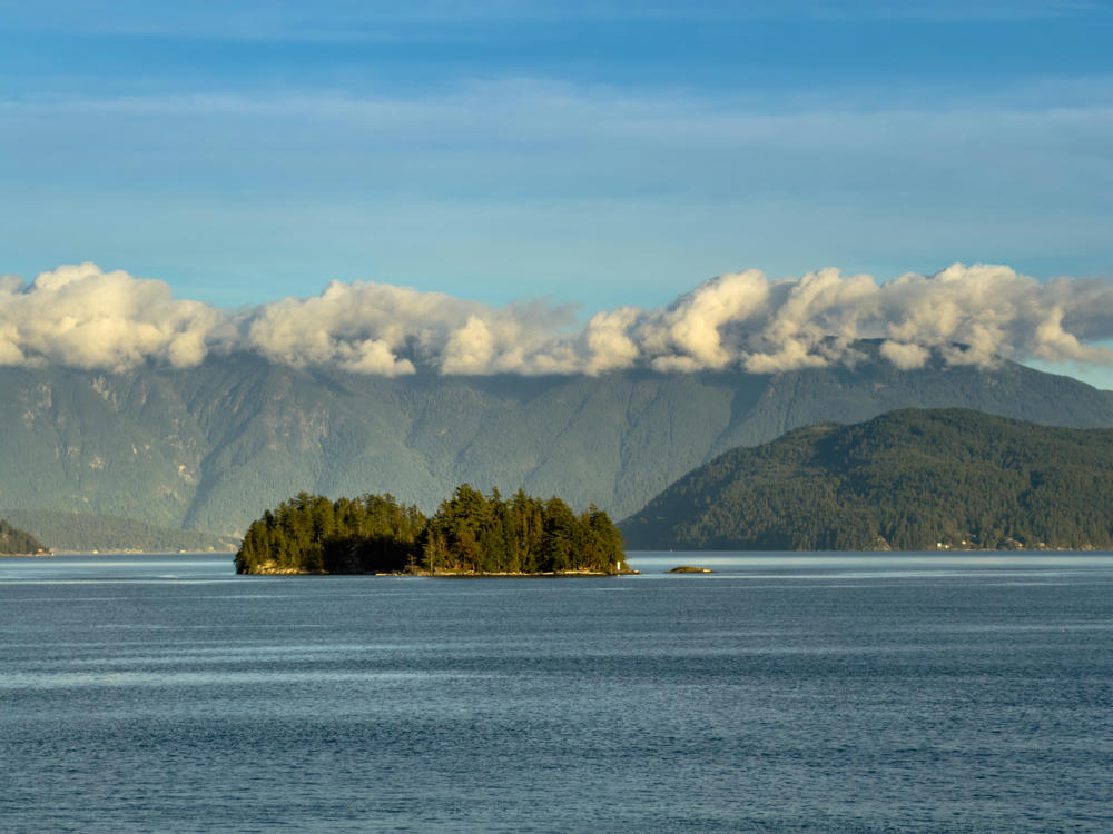
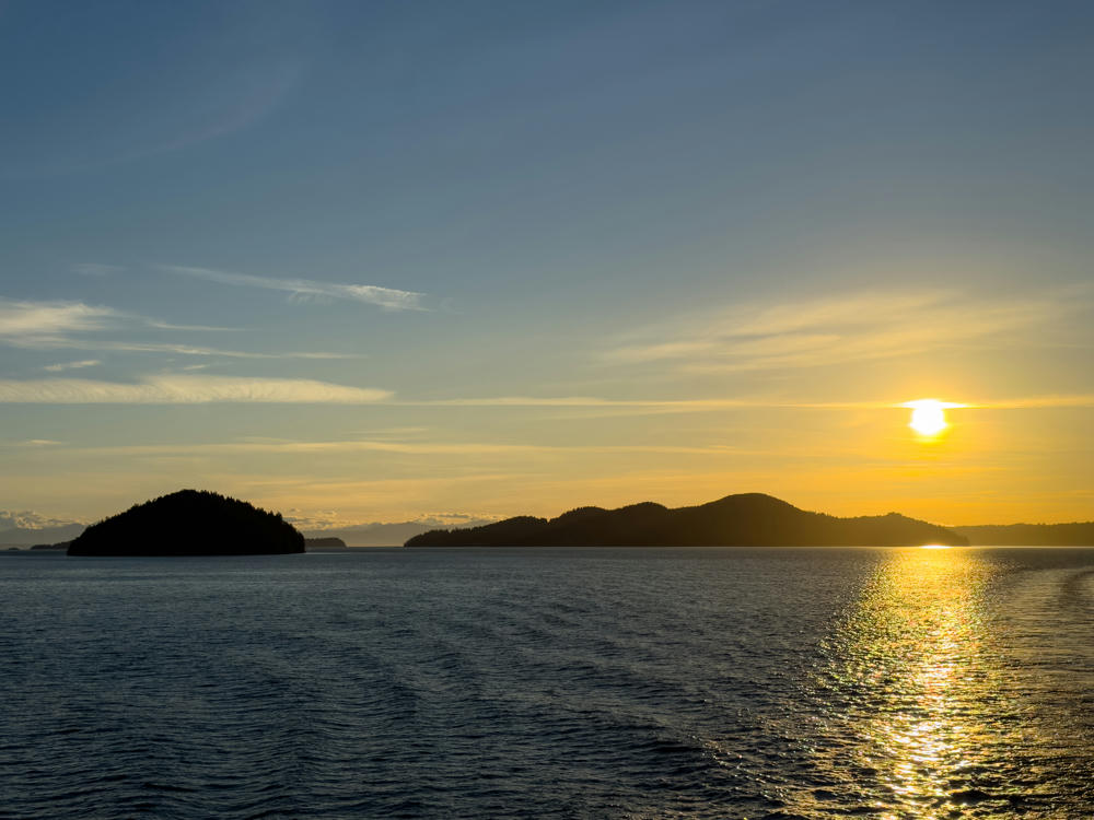
During the day between, I drove over to the Horseshoe Bay ferry terminal and took the 40-minute sailing up to Gibsons and the gateway to the Sunshine Coast. The scenery was stunning!

A BC Ferries vessel docked at the Horseshoe Bay terminal, with a marina full of small boats moored in the foreground and a forested mountainside rising behind under a cloudy sky. Low cloud clings to the hills across the inlet, and a wooden pier extends from the left shore.
Horseshoe Bay, West Vancouver, British Columbia, Canada
A coastal inlet north of Horseshoe Bay with calm dark water, a steep forested mountainside dropping to the rocky shore on the right, and distant cloud-capped mountains across the water under a mostly cloudy sky. A weathered, rusting white wooden breakwater or piling structure juts into the water in the lower right foreground.
north of Horseshoe Bay, West Vancouver, British Columbia, Canada
A wide view across calm blue ocean water toward forested coastal mountains, with low clouds clinging to the slopes on the right and a small island in the distance to the left under a vast sky streaked with wispy cirrus clouds.
north of Horseshoe Bay, West Vancouver, British Columbia, Canada
A calm coastal inlet under a heavy, overcast sky, with a forested hillside and a prominent rounded green hill rising along the far shore. Houses dot the tree-covered slopes above a shoreline that includes a ferry terminal and dock structures on the right, all mirrored faintly in the still dark water.
Langdale, British Columbia, Canada

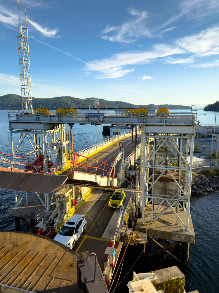
What did I do upon arrival? Drove to the very far end of the road. There’s another ferry that carries route 101 onward to Saltery Bay and Powell River, but I didn’t have time to make it there and back.

A calm lake seen from a mossy, rocky shoreline framed by two tall conifer trees with exposed roots, under an overcast grey sky. Forested hills and low mountains line the far shore of the still water at Dan Bosch Park near Earls Cove, British Columbia.
Dan Bosch Park, south of Earls Cove, British Columbia, Canada
A calm lake under a heavy, overcast gray sky, with a tree-lined far shore of dense evergreens and a few scattered cabins. A floating buoy line marks a swimming area in the foreground, and the still water reflects the clouds and forest.
Dan Bosch Park, south of Earls Cove, British Columbia, Canada

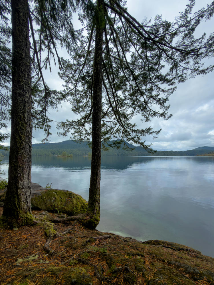
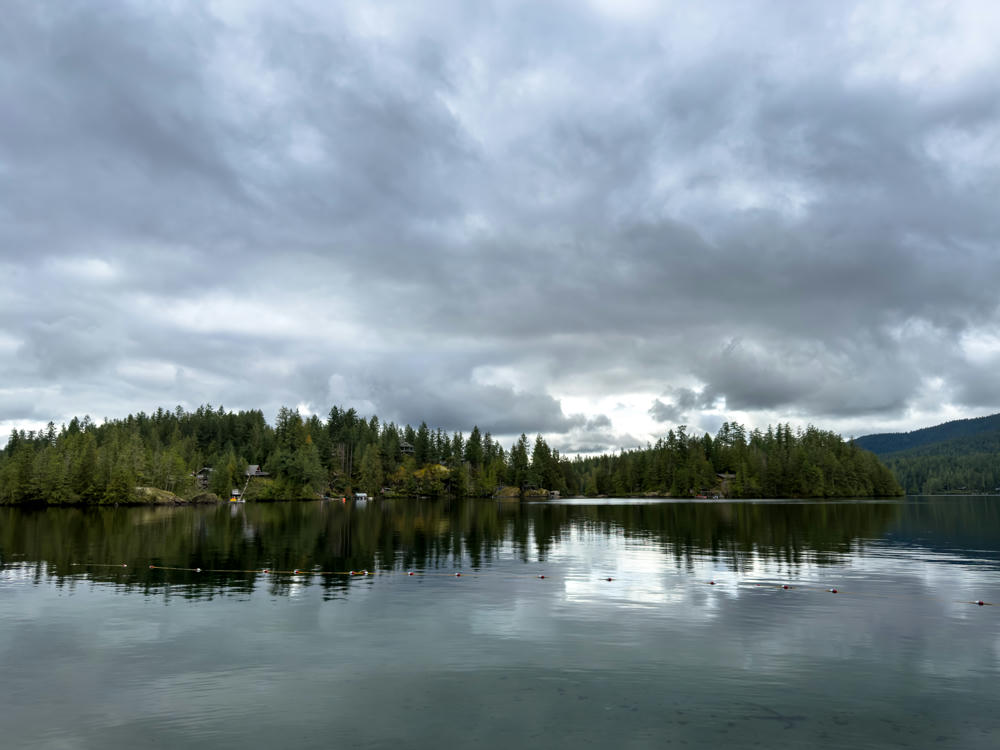
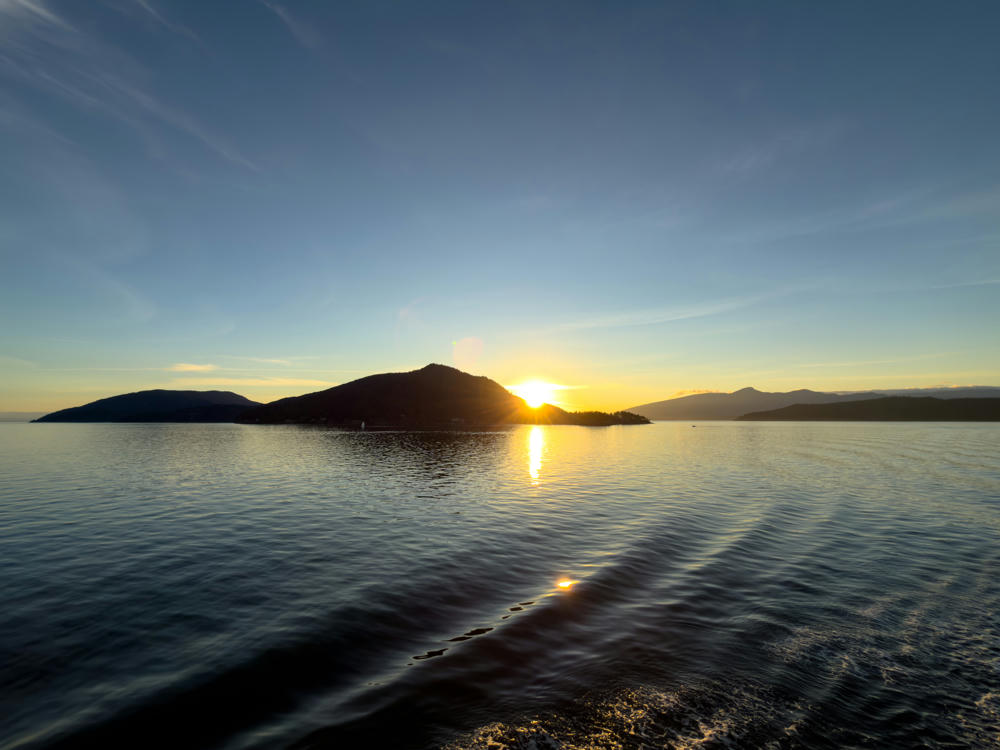
On the way back to Gibsons, I took some more time to see the sights.

A calm marina in Madeira Park, British Columbia, with fishing boats, sailboats, and small motorboats moored along docks on a gray overcast day. Forested hills and a few waterfront homes line the far shore, all reflected in the still water.
Madeira Park, British Columbia, Canada
A small-craft marina in Gibsons, British Columbia, with sailboats, fishing boats, and a white powerboat marked “Harbour Ferry” tied up at wooden docks under a heavy grey overcast sky. Behind the harbour, a hillside town of houses and waterfront buildings rises among evergreen trees, with a red multi-storey building standing out on the right.
Gibsons, British Columbia, Canada

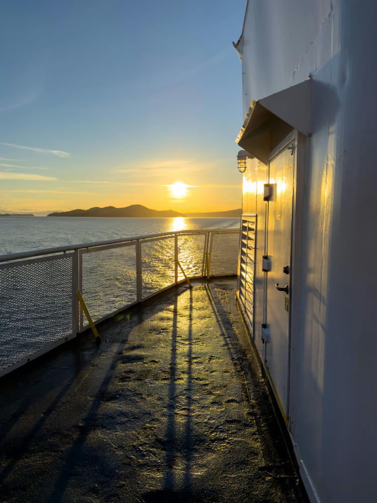
I timed my return to Vancouver for the sunset hour. So worth it:

Langdale Ferry Terminal, Langdale, British Columbia, Canada
A small forested island sits in calm blue ocean water, with tree-covered mountains rising behind it and a band of white clouds clinging to the mountain ridge under a pale blue sky.
Langdale Ferry Terminal, Langdale, British Columbia, Canada
The exterior deck of a ferry at sunset, with a white painted hull, a metal door and a wall-mounted caged light on the right, and a white railing along the left edge overlooking calm water with low forested islands and hills on the horizon. The low sun casts a golden glow and long shadows across the wet deck.
north of Bowen Island, British Columbia, Canada
The sun hangs low above silhouetted forested islands across calm ocean water, casting a golden glow across the sky and a shimmering reflection on the sea, with a faint lens flare visible at left.
north of Bowen Island, British Columbia, Canada
The sun sets behind a silhouetted forested island ridge, casting a bright golden reflection across calm rippling water as seen from a boat near Bowen Island, British Columbia. Distant hills and headlands stretch along the horizon beneath a clear blue sky streaked with wispy clouds.
east of Bowen Island, British Columbia, Canada

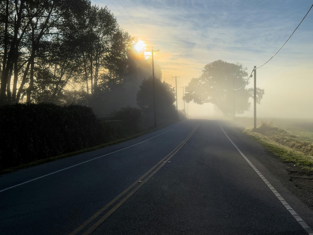
On Sunday morning, as I was heading back home, I enjoyed the foggy landscape after my morning coffee.

A misty rural two-lane road with double yellow center lines stretches into morning fog, the low sun glowing through silhouetted trees and utility poles along the left side. Power lines, a hedgerow, and an open field flank the empty road northeast of Langley, British Columbia.
northeast of Langley, British Columbia, Canada
Langley to Earl’s Cove, British Columbia, Canada, and back · 359 km / 223 mi
(Mouse over or tap on the markers to see the photos there. Use the button to adjust the map’s position and zoom.)

If you’ve enjoyed this …

Subscribe to my free and occasional (never more than weekly) e-mail newsletter with my latest travel and other stories:

Or follow me on one or more of the socials: