Hi, I'm Eric.

I’m an avid world traveler, photographer, software developer, and digital storyteller.

I help implement the Content Authenticity Initiative at Adobe.

Search Results

Victoria Harbour Flightseeing

9 August 2026 65 km / 40 mi (map)

  • Added to Eric Scouten :: Travel on 18 August 2026
  • Canada 15

Lisa and I were in Victoria for a fun weekend away. This morning, before heading home, I took the opportunity to take a quick flightseeing trip around the harbour area (still getting used to Canadian spelling!) operated by Harbour Air.
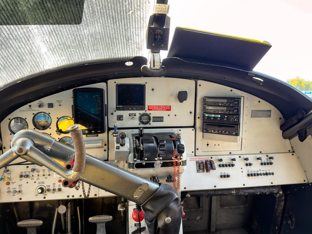
Victoria Harbour Airport, Victoria, British Columbia, Canada
The cockpit of a floatplane with an extensive instrument panel of analog gauges, digital displays, radios, switches, and a control yoke, labeled “C-FHAA Harbour Express 309,” with a sun-shade over the left windshield and calm water visible through the right window.
Victoria Harbour Airport, Victoria, British Columbia, Canada
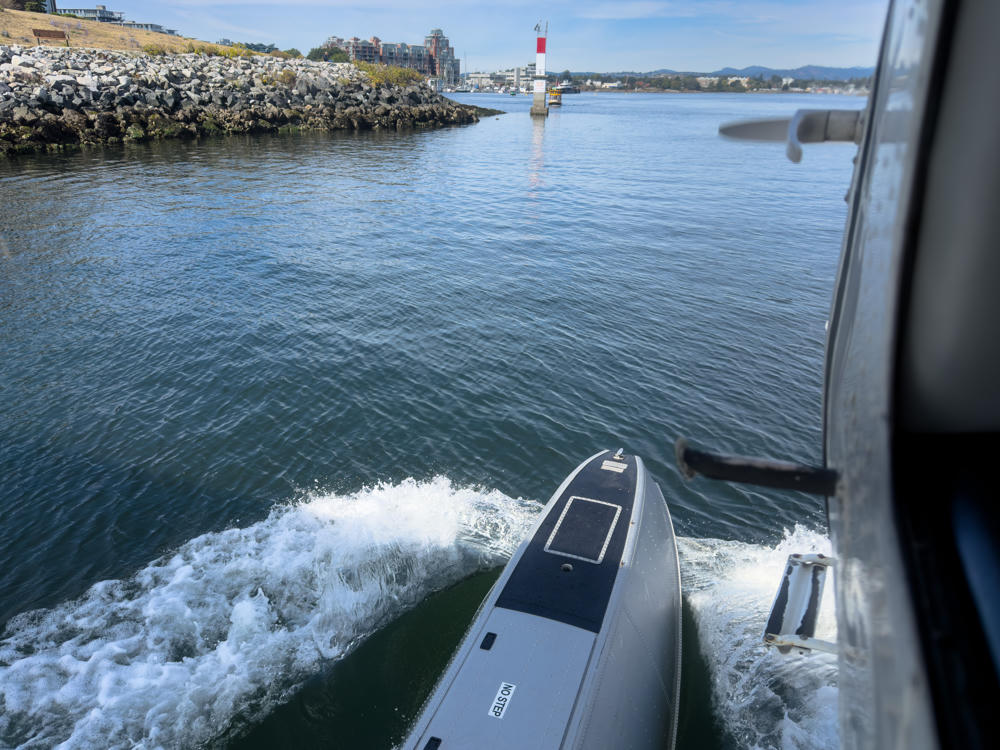
View from a moving seaplane’s float as it taxis across Victoria Inner Harbour, with churning white water spray beside the pontoon. A rocky breakwater with waterfront buildings lines the shore, a red-and-white channel marker beacon stands in the harbour, and distant hills rise under a partly cloudy blue sky.
Victoria Inner Harbour, Victoria, British Columbia, Canada

Off we go!

Victoria Middle Harbour, Victoria, British Columbia, Canada
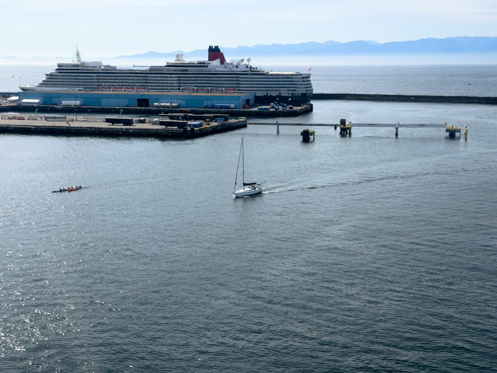
A large Cunard cruise ship with its distinctive red and black funnel docked at a harbour terminal, while a white sailboat and a small rowing shell move across the calm harbour water in the foreground, with distant hazy mountains along the horizon.
above Victoria Outer Harbour, Victoria, British Columbia, Canada
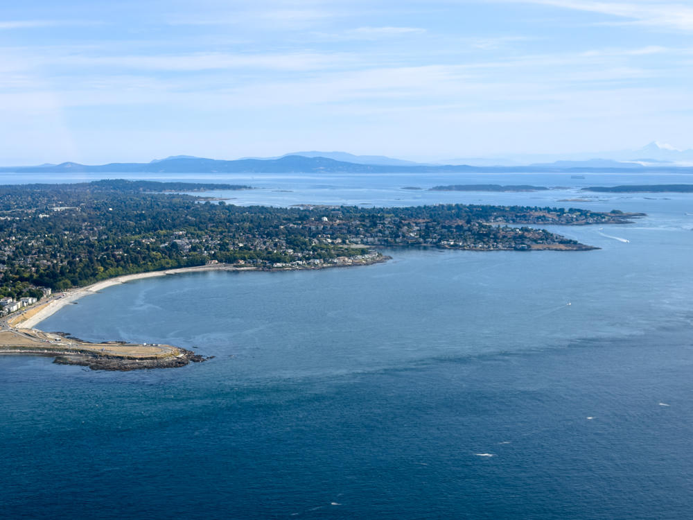
An aerial view over the deep blue Salish Sea looking toward a wooded coastline dotted with houses, a curving sandy beach, and a low rocky point, with scattered islands and distant mountains including a snow-capped peak on the hazy horizon under a pale blue sky.
above Salish Sea, south of Victoria, British Columbia, Canada
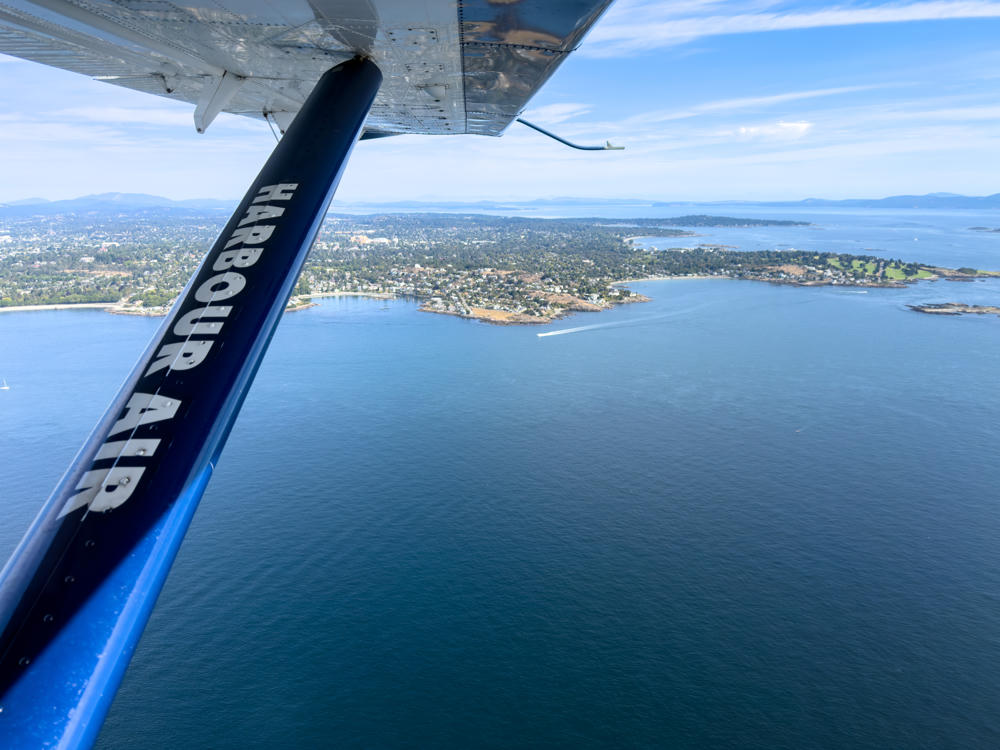
An aerial view from a Harbour Air seaplane, with the aircraft’s blue wing strut labeled “HARBOUR AIR” in the foreground, looking down over the blue waters of the Salish Sea toward a green, tree-lined coastline dotted with houses near Oak Bay, British Columbia, with distant islands and hills under a bright sky.
above Salish Sea, south of Oak Bay, British Columbia, Canada
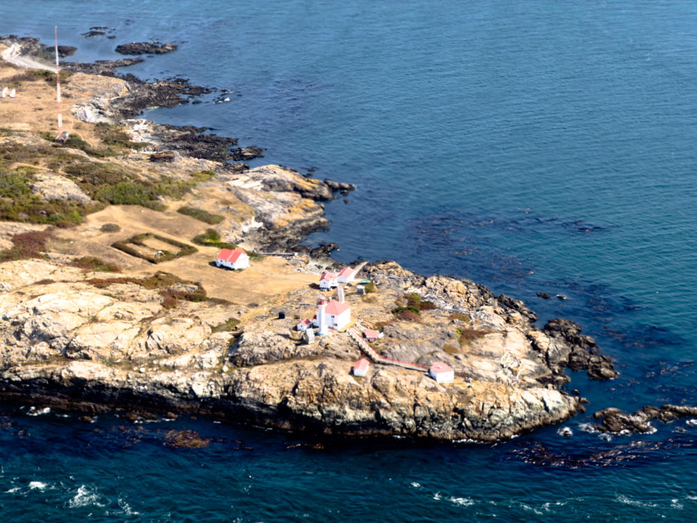
Aerial view of a rocky island lighthouse station surrounded by deep blue ocean, with several white buildings topped by red roofs, a short white lighthouse tower, connecting walkways, and a tall red-and-white radio mast on the golden-grassed terrain.
above Trial Islands, south of Oak Bay, British Columbia, Canada
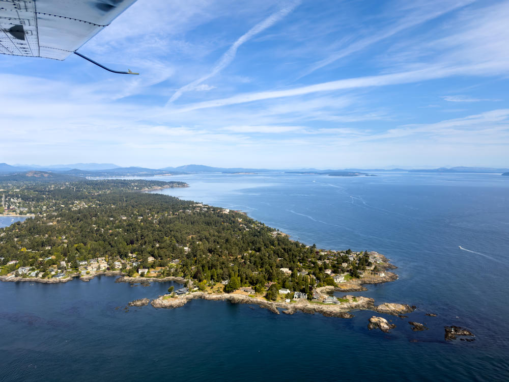
Aerial view from a small floatplane, with its wing strut visible in the upper left, looking down over a forested, rocky peninsula dotted with houses that juts into the deep blue Salish Sea. Distant islands and hazy mountains line the horizon under a bright sky streaked with wispy clouds.
above Salish Sea, east of Saanich, British Columbia, Canada
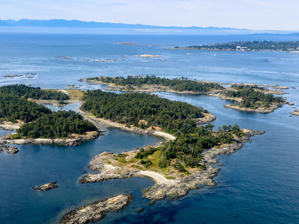
Aerial view of a cluster of small, forested rocky islands with dense evergreen trees, rugged shorelines, and pale gravel beaches, surrounded by blue ocean water. In the distance a coastal town and a hazy mountain range meet the horizon under a pale blue sky.
above Chatham Islands, east of Oak Bay, British Columbia, Canada
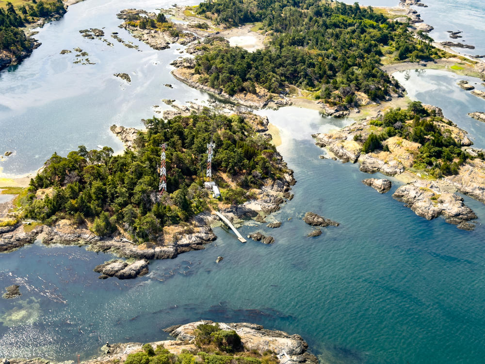
An aerial view of a cluster of small forested islands surrounded by calm blue-green water, rocky shorelines, and exposed tidal flats. Two red-and-white lattice communication towers rise above the trees on the central island, near a small building and a wooden dock reaching into the channel.
above Chatham Islands, east of Oak Bay, British Columbia, Canada
above Salish Sea, south of Oak Bay, British Columbia, Canada
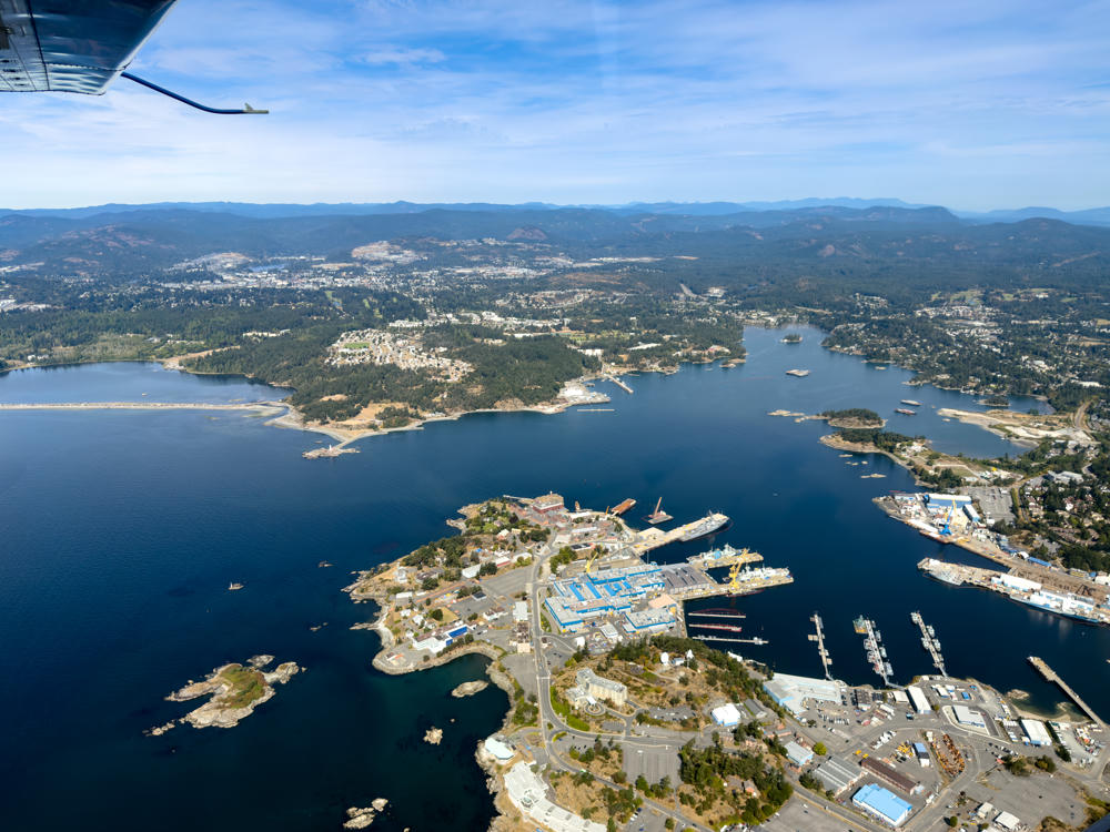
An aerial view from a small aircraft, with a wing strut and part of the plane visible in the upper left, looking down over a peninsula shipyard and naval harbour surrounded by dark blue water, with wooded suburbs and distant mountains under a hazy blue sky.
above Esquimalt, British Columbia, Canada
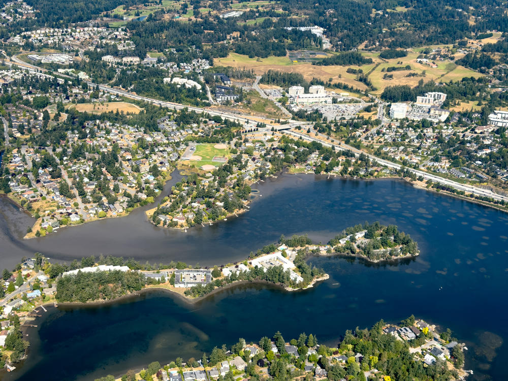
An aerial view over Saanich, British Columbia, showing a dark, meandering lake or inlet dotted with small wooded islands and peninsulas lined with houses, apartment buildings, and mature evergreens. In the distance a highway winds through suburban neighbourhoods, a baseball diamond and tennis courts, mid-rise buildings, and rolling forested hills and dry golden fields under bright daylight.
above Saanich, British Columbia, Canada
Aerial view over Esquimalt and Victoria, British Columbia, showing a sprawling coastal city of low buildings, marinas and harbours winding between wooded peninsulas, with the shimmering Strait of Juan de Fuca and hazy distant mountains beyond under a pale blue sky.
above Esquimalt, British Columbia, Canada
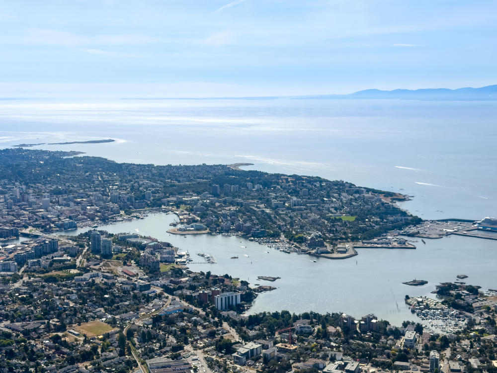
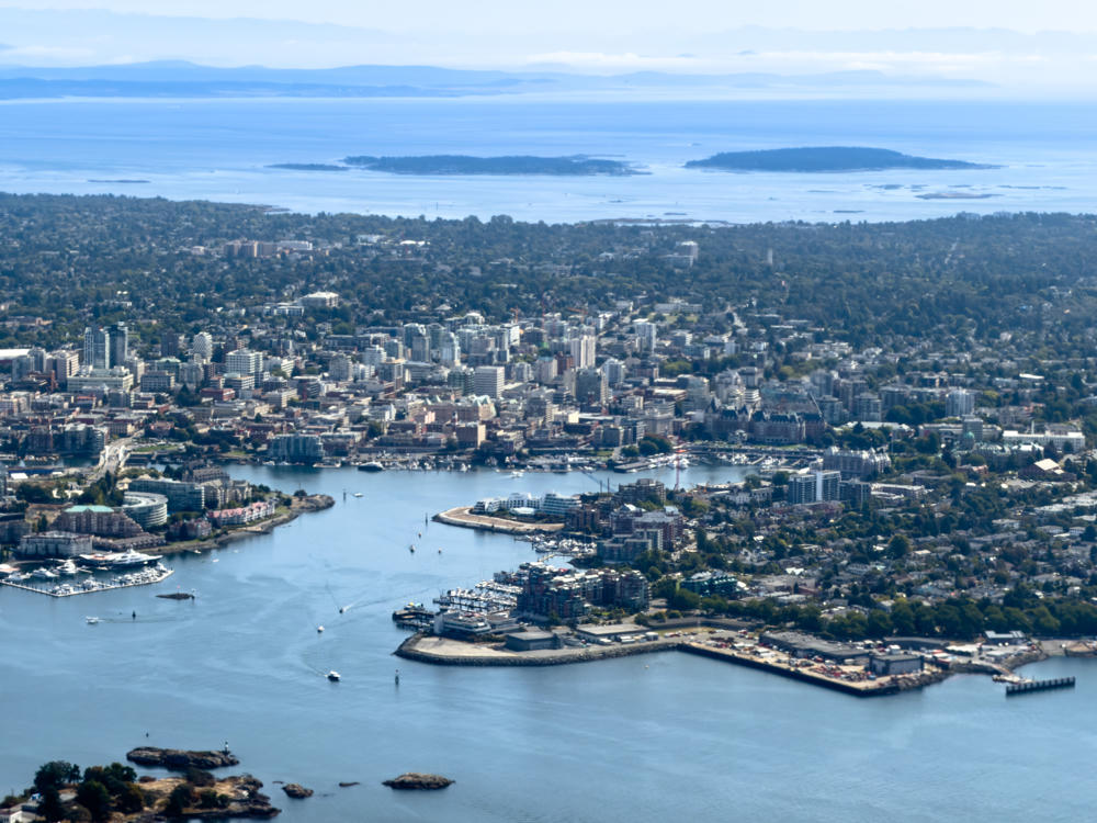
Aerial view of a coastal city built around a harbor, with clustered downtown high-rises, marinas full of moored boats, and residential neighborhoods spreading into forested hills, all fronting the broad blue waters of the Salish Sea with low islands and hazy distant mountains on the horizon.
above Salish Sea, south of Esquimalt, British Columbia, Canada
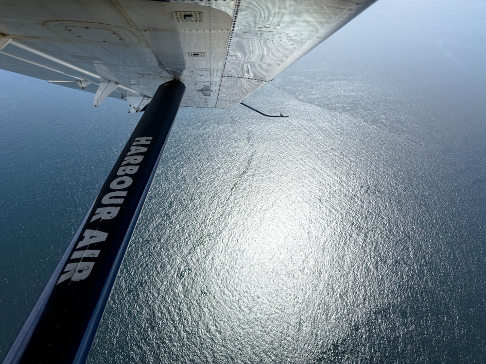
View from a floatplane in flight, looking out under the wing and diagonal support strut marked “HARBOUR AIR,” over sunlit, shimmering waters of the Salish Sea below.
above Salish Sea, south of Esquimalt, British Columbia, Canada
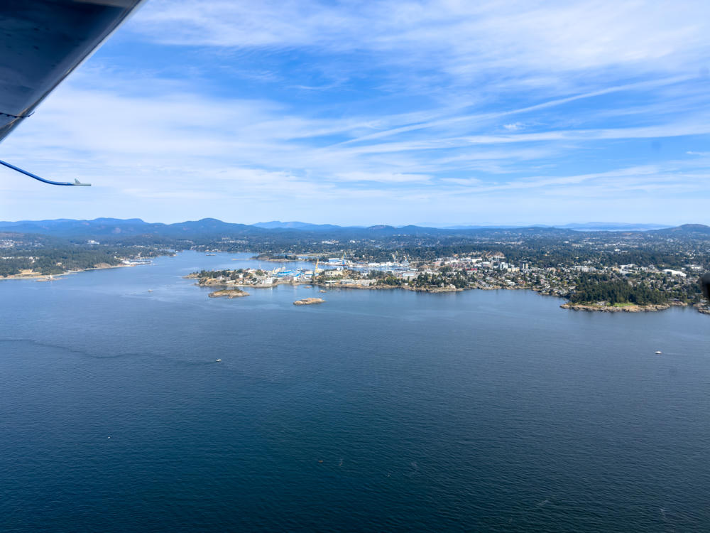
An aerial view from a small aircraft, with a wing strut and float visible in the upper left, looking over the blue waters of the Salish Sea toward a rocky, wooded coastline and harbour with docks, cranes, and buildings near Esquimalt, backed by low forested hills under a bright sky with wispy clouds.
above Salish Sea, south of Esquimalt, British Columbia, Canada

Here we are on final approach and landing. From my track log, it looks like we touched down at about 130 km/h / 81mph.
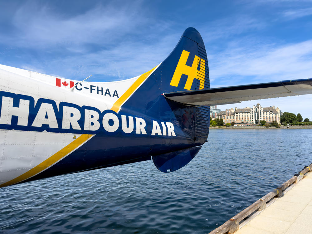
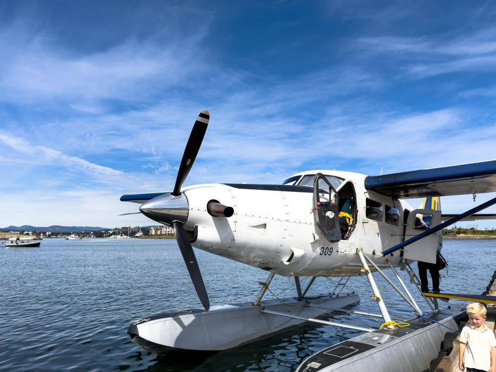
above Salish Sea, south of Esquimalt, British Columbia, Canada
The rear fuselage and tail of a Harbour Air seaplane with registration C-FHAA, painted in blue, white and yellow with a Canadian flag, floating on the calm water of Victoria Harbour with a waterfront dock and hotel buildings across the water under a partly cloudy blue sky.
Victoria Harbour Airport, Victoria, British Columbia, Canada
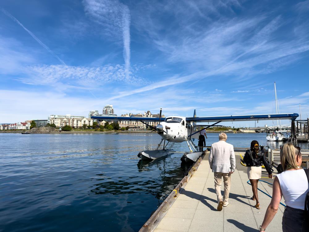
A white single-engine floatplane numbered 309 tied up at a harbour dock under a bright blue sky with wispy clouds, its black three-blade propeller and pontoons in clear view. A blond young boy in a light shirt stands at lower right, a person boards the plane behind it, and a small boat and distant waterfront buildings sit across the calm harbour water.
Victoria Harbour Airport, Victoria, British Columbia, Canada
around Victoria, British Columbia, Canada · 65 km / 40 mi
(Mouse over or tap on the markers to see the photos there. Use the button to adjust the map’s position and zoom.)

If you’ve enjoyed this …

Subscribe to my free and occasional (never more than weekly) e-mail newsletter with my latest travel and other stories:

Or follow me on one or more of the socials: